Ocean Color Remote Sensing Specialist Job – USA

IBSS is hiring an Ocean Color Remote Sensing Specialist to develop hyperspectral oceanographic remote sensing products that are applicable to the NASA Plankton, Aerosol, Cloud, ocean Ecosystem (PACE) and future ocean color missions. The remote sensing specialist will work with a team of federal (NOAA/NEFSC/EDAB) and academic scientists to compile and collect in situ optical measurements and create operational products relevant for fisheries science and ecosystem based management.
 

We would appreciate you sharing this posting with potential candidates who have expertise in ocean color remote sensing data and algorithm development. A strong candidate will also have good coding and communication skills, and be expected to lead efforts to transition newly developed products to operational status.

Please distribute this notice widely to those you believe may be interested and are strong candidates for this position.  This is not a NOAA position.

If you have any questions, please contact Lacey Bluemel ( lacey.bluemel@ibsscorp.com).

Sr. Phd/Postdocs! New NSF Accelnet BioGeoSCAPES Fellows Program

We are excited to launch a BioGeoSCAPES Fellows program funded by the NSF AccelNet award Development of an International Network for the Study of Ocean Metabolism and Nutrient Cycles on a Changing Planet (BioGeoSCAPES). This new program will bring together an international, interdisciplinary cohort of early career (postdocs and senior graduate students) researchers working in the areas of ocean metabolism, biogeochemical cycling, biological oceanography, chemical oceanography, and marine microbiology. We encourage applicants from both experimental and modeling backgrounds.
Program goals

  1. Develop an international community of early career BioGeoSCAPES scientists
  2. Catalyze research collaborations among BioGeoSCAPES science disciplines
  3. Support international collaborations and development of global BioGeoSCAPES scientist communities
  4. Develop the next generation of leaders in ocean biogeochemistry

Each Fellow will each receive up to 5,000 USD professional development award that can be used for travel related to laboratory exchanges, courses, workshops or conferences (this award can be spent over a ~2 year period). A cohort of up to 8 Fellows will participate in monthly networking events for at least one year, as well as an in-person workshop in summer 2024.
Eligibility and Application Instructions

Postdoctoral researchers and senior graduate students from any nation who are working on BioGeoSCAPES-relevant research are eligible to apply.

Submit your application (including an abbreviated 2-page CV) by June 15.

If you cannot use Google Forms, please contact ocb_news@whoi.edu to apply.

Applications are due June 15, 2023 and will be reviewed shortly thereafter. Applicants will be informed by August, and cohort activities will begin September, 2023. Applications will be evaluated based on the following criteria:

  1. Applicant’s readiness level to benefit from professional development activities of the Fellows Program
  2. Quality, novelty, and relevance (to BioGeoSCAPES mission) of applicant’s research activities to date
  3. Applicant’s authentic experience and/or interest in interdisciplinary research endeavors
  4. Applicant’s leadership experience and/or potential to help advance the BioGeoSCAPES mission

Questions: info@biogeoscapes.org

End User Outlooks on Earth Observation – a PrimeWater and IWA webinar

The PrimeWater – A Horizon2020 Project and the International Water Association are hosting the ‘End User Outlooks on Earth Observation’ webinar on 18 May 2023 at 12:00 London time.

The focus of this webinar is to gather opinions and feedback from an expert panel of EO practitioners on the use of the services provided by PrimeWater.

Register now! https://iwa-network.org/learn/end-user-outlooks-on-earth-observation/

PhD Fellowship Position in Remote sensing of Water Quality

A 3-year PhD fellowship is proposed by the Laboratory of Oceanology and Geosciences LOG (Wimereux, France) on the water quality variability by multi-sensors remote sensing in inland water/estuarine/deltaic environments. Application to 1) Hauts-de-France watershed up to estuaries and 2) Lower Mekong watershed up to the delta.

Objectives

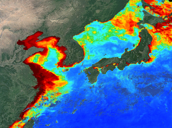
 Multisensor remote sensing techniques are crucial for understanding the functioning of marine, coastal/littoral and inland water systems as it is a synoptic technique useful to improve our understanding of water quality across the Continental/Sea continuum. Water quality variables that can be assessed by multispectral satellites are turbidity, chlorophyll (an indicator of phytoplankton biomass, trophic and nutritional status), colored dissolved organic matter (an indicator of organic matter and aquatic carbon), suspended solids and non-algal particles. The variable, surface water temperature, is also considered as a good indicator of the environment in term of biodiversity/climate change and species migration corridor with well-defined thermal trajectories. However, the TS has never been analyzed concomitantly with other variables, which greatly limits our understanding of the phenomena where water masses are extremely dynamics and vary from nothing to nothing in composition and quantity to within half an hour!

Via well-adapted algorithms and appropriated sensors (TRISHNA, Landsat, Sentinel, hyperspectral UAV, etc), handled images enable us to complete and densify the observations for better management of the territories, in this case here 1) the Hauts-de-France and 2) the Lower Mekong (VolTransMESKONG CNES project & Vietnam-France joint laboratory LOTUS). Indeed, the water quality parameters (WQP) are useful for the evaluation of the sanitary quality facilitating a fortiori the good management of these spaces from the ecological, economic and also touristic point of view (bathing waters). Through this thesis project, for the HdF, the spatial/temporal monitoring of these indicators will, among other things, make it possible to understand the evolution and interactions between water masses and marine and coastal resources (biological and mineral) with a focus on estuaries. For the BM, climatic and anthropogenic forcings will be apprehended through the spatial/temporal analysis of water quality, its degradation and also the hydro-sedimentary flows from the watershed to the delta.

Qualifications:  Master degree in remote sensing or oceanography or environmental sciences


Application closure date: May 1 2023

Position Length: 3-year fellowship from October 2023

Location: The candidate will be located at LOG, 32 avenue Foch, 62930 Wimereux, France

Applicants must submit:

–       A detailed CV, including the e-mail and phone number for three references

–       A short cover letter explaining the applicant’s experience related to the position and motivation

For questions and application’s submission, please contact:

Cédric Jamet: cedric.jamet@univ-littoral.fr

Charles Verpoorter : Charles.verpoorter@univ-littoral.fr