2nd introductory webinar to the May 2022 International Conference
“Groundwater, key to the Sustainable Development Goals”
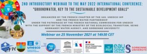
25 November 2021
14h30 – 16h30 CET
Register here
The 2030 Agenda and its 17 Sustainable Development Goals (SDGs) adopted by all UN Member States are our universal blueprint to protect the planet and to ensure that all people enjoy peace and prosperity by 2030.
Water cuts across all SDGs and the availability and sustainable management of water and sanitation are central to the achievement of the 2030 Agenda. Water is crucial for advancing human rights, health, education, gender equality and work, as well as for food security, reducing poverty, tackling climate change, and enabling peace, justice, and sustainability. The eight
targets of SDG 6 on clean water and sanitation cover universal and equitable access to water, sanitation, and hygiene; water quality; water-use efficiency; integrated water resources management (IWRM); water-related ecosystems; international cooperation; and local participation. Beyond SDG 6, a dozen SDG targets are directly linked to freshwater.
Some 2.5 billion people depend solely on groundwater for their daily needs. The sustainable and science- based management of this precious resource is therefore key to achieving the SDG water-related targets.
• This webinar will explore the role and importance of the sustainable management of groundwater in the context of the SDGs and the SDG water-related targets, as well as underline the vital importance of preserving the quality and availability of groundwater in the face of climate change and increasing pressures on the resource.
• It will also update participants on the upcoming international Conference on Groundwater and the SDGs (‘Groundwater: Key to the Sustainable Development Goals’). The link of the conference is above. The conference is co-organized by the French Chapter of the International Association of Hydrogeologists (CFH-AIH), UNESCO’s Intergovernmental Hydrological Programme (UNESCO IHP), and the French Water Partnership (FWP), the Conference will take place in Paris on 18- 20 May 2022 under the patronage of the French National Commission for UNESCO and with the support of the French Ministry of the Ecological Transition, the Seine-Normandy Water Agency, and Sorbonne University.
• French/English simultaneous interpretation will be provided


