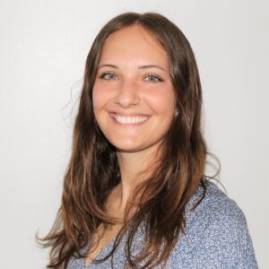
 Dr. Megan Coffer Dr. Megan Coffer |
Dr. Megan Coffer is a research scientist in NOAA’s Center for Satellite Applications and Research through Global Science & Technology, Inc. She served as co-vice-chair of the GEO AquaWatch Early Career Society during its inaugural year, and now serves as the society’s co-chair; she is also a member of the GEO AquaWatch Management Team. Dr. Coffer joined NOAA in 2022 after completing a postdoctoral fellowship at the U.S. EPA. She holds a Ph.D. in Geospatial Analytics and a M.S. in Atmospheric Science, both from North Carolina State University, and a B.S. in Mathematics from Meredith College. Her research interests focus on satellite remote sensing technologies to study aquatic ecosystems, including monitoring cyanobacterial blooms in inland lakes and reservoirs and mapping seagrass extent along the coast. |
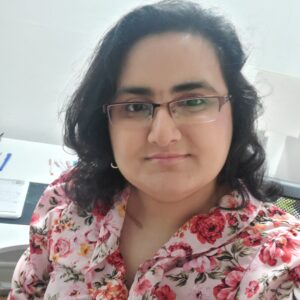 MSc. Rabia Munsaf Khan MSc. Rabia Munsaf Khan |
Rabia Munsaf Khan is a Fulbright doctoral candidate at the State University of New York – College of Environmental Science and Forestry (SUNY ESF), specializing in geospatial information science and engineering. Her research focus lies at the intersection of technology and environmental sustainability, with a particular emphasis on leveraging geospatial data to address pressing issues such as water quality to achieve sustainable development goals (SDGs). Rabia earned her Master’s degree in Remote Sensing and Geographic Information Science (GISc) from the Institute of Space Technology, where she graduated summa cum laude, topping her class. She also holds a distinguished gold medal in BS Hons Space Sciences from the University of The Punjab. |
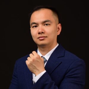 Dr. Duy Nguyen Dr. Duy Nguyen |
Duy is an “Impossible Without You” CERF fellow working in the CSIRO AquaWatch Mission, with expertise in Computational Fluid Dynamics and turbulence modeling. His current projects involve hydrodynamic and water quality modeling of lakes and rivers, combined with satellite and HydraSpectral imagery and in-situ sensory of inland water quality. He is also working as a model developer in the Digital Water & Landscapes – Hybrid Modelling for Water Security project, where the team is integrating physical systems and AI/ML modeling of water quality and quantity. Moreover, he works toward developing a fish kill index and an early warning tool for fish kill in different continental spatial and temporal scales, which also leverage remote sensing capability to monitor dead fish and basic variables to determine organic matter in rivers and lakes. |
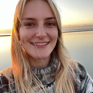 Dr. Harriet Wilson Dr. Harriet Wilson |
Dr. Harriet Wilson is a research scientist in the Earth and Planetary Observation Research Group at the University of Stirling in Scotland. She is currently serving as the co-vice-chair of the GEO AquaWatch Early Career Society and is also leading the UNEP World Water Quality Alliance Earth Observation workstream. Dr Wilson holds a Ph.D. in physical limnology, focussing on the impact of climate change and extreme events on lakes, and was a Marie-Curie scholar, trained within the Innovative Training Network “MANTEL”. Her current research interests focus on understanding how satellite remote sensing of aquatic ecosystems can be more widely used within the water industry and to benefit communities and individuals. |
This list in not exhaustive. Head shot and bio are not obligatory for regular ECS members.
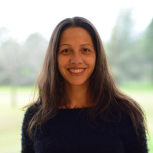 Dr. Anabella Ferral Dr. Anabella Ferral |
Anabella Ferral received her PhD in Chemistry and her MSc. in Space Applications for Early Warning and Response to Emergencies from the National University of Córdoba (UNC), Argentina. She worked for the Secretary of Water Resources of Córdoba province and was the Head of the Master’s Degree in Spatial Information Applications at the Gulich Institute (which belong to CONAE, National Space Agency) from 2015 to 2020. Currently she works at Gulich Institute as a Professor in environmental remote sensing courses and as a Researcher of the National Council of Scientific and Technical Research of Argentina (CONICET). She was Member of the organising committee of the Spring School on Remote Sensing (2016, 2017, 2018 and 2021), organized jointly with IEEE-GRSS Argentine Chapter. She made a research stay at the Royal Military Academy of Belgium to work with hyperspectral data during 2022. Her research focuses on remote sensing of water resources’s environmental quality indicators within the framework of the Sustainable Development Goals (SDGs), through the integration of satellite data, numeric simulations, field campaigns, and laboratory measurements. Since September 2023, she has served as Associate Editor of the Geoscience and Remote Sensing Magazine published by IEEE-GRSS. She joined GEO AquaWatch community after participating in “Water talks webinars” in October 2023. |
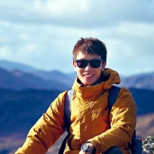 Dr. Dalin Jiang Dr. Dalin Jiang |
Dalin Jiang received his PhD in remote sensing from the University of Tsukuba, Japan. He is now a research fellow at the University of Stirling, UK. His researches are mainly focusing on the development of algorithms for retrieving water quality variables including Secchi disk depth, total suspended solids (TSS), coloured dissolved organic matters (CDOM) from satellite images, and the application of Earth observation in understanding how climate change and human activities impact the aquatic ecosystems. He has led/joined field campaigns in inland, coastal and open ocean waters in China, Japan, Indonesia, UK, Portugal, Romania, and Italy. He participated and works on European Union Horizon-2020 funded projects (e.g., CoastObs, MONOCLE, CERTO, DOORS), and the European Space Agency (ESA) funded Lakes_cci project. |
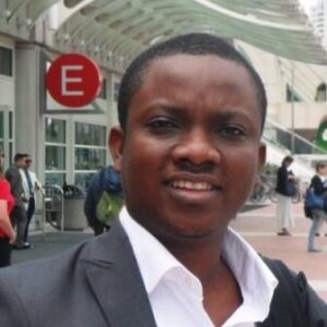 Mr. David Tolu Afolayan Mr. David Tolu Afolayan |
David Tolu Afolayan is a strong advocate for sustainable development, the Chief Executive Officer of GIS Konsult Ltd and also a Business Partner to Environmental Systems Research Institute ESRI, California. David provides education and professional consultancy services for both public and private sector on the strength of the Geographical Information Systems GIS technology. David has a Bachelor’s degree in Architecture from the Federal University of Technology, Akure and a Master of Science degree in the Geographic Information Systems (GIS) from the University of Ibadan, Nigeria. David is the deputy Chair of the Geospatial Society of Nigeria, GEOSON, Oyo State Chapter. In 2020 David was appointed a member of Oyo State COVID-19 Containment Committee, to develop and implement a novel and effective geo-intelligence driven strategy that combined the indigenous practice of community engagement to contain COVID-19. David was also appointed a member of an ad hoc Digital Literacy Implementation Committee (DLIC) in 2021 to accelerate digital transformation in Southwest Nigeria. |
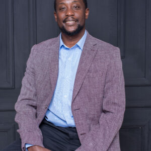 Mr. James Wanjohi Nyaga Mr. James Wanjohi Nyaga |
Mr. James Wanjohi Nyaga is currently a project coordinator with the Regional Center for Mapping of Resources for Development (RCMRD), an inter-governmental institution based in Nairobi, Kenya with 23 country membership in East and South Africa. He has led the implementation of satellite based water quality mapping and monitoring of in-land lakes in East Africa, including Lake Victoria, Lake Tanganyika and Lake Malawi. He has contributed to the analysis and production of water quality indicators such as Chlorophyll-a, Lake Surface Temperature, and Secchi Depth, and remote sensing of invasive floating vegetation (Hyacinth) using a multi-sensor approach. He holds an Msc in Meteorology, with over 13 years of professional experience, and has current interest in water quality modeling using SWAT and disaster risk management. |
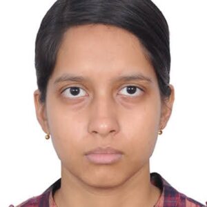 MSc. Sumita Bhattacharyya MSc. Sumita Bhattacharyya |
Sumita Bhattacharyya is a PhD candidate at Manipal Academy of Higher Education (MAHE), conducting her research at the Ashoka Trust for Research in Ecology and the Environment (ATREE), Bengaluru. Her research focuses on understanding the linkages between water chemistry, aquatic macrophytes and avian composition and stakeholders’s usage of urban lakes in tropical regions. The synthesis of the research would aid in developing rejuvenation or management targets related to lake water quality and allow for citizen based monitoring of the lake water quality. She has worked in Sustainable Use of Natural Resources to Improve Human Health and Support Economic Development (SUNRISE) programme delivering National Capability, funded by the UK Natural Environment Research Council. |
 Dr. Megan Coffer
 MSc. Rabia Munsaf Khan
 Dr. Duy Nguyen
 Dr. Harriet Wilson
 Dr. Anabella Ferral
 Dr. Dalin Jiang
 Mr. David Tolu Afolayan
 Mr. James Wanjohi Nyaga
 MSc. Sumita Bhattacharyya