WWQA 3rd Annual Meeting – January 26-27, 2022

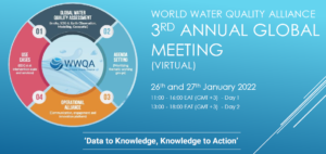
The theme of this meeting is ‘Data to Knowledge, Knowledge to Action’ and the objectives are:

1. WWQA Coordination Team Update
2. Present ongoing work and interfaces and products contributing towards the World Water Quality Assessment that will be shared on the UNEP World Environment Situation Room (WESR) as the main portal to update UNEP Member States towards the World Water Quality Assessment and WWQA workstreams contributing to this
3. Understand the role of in-situ data on water quality available from GEMS Water. Identify requirements for in-situ data within the WWQA community to better support stakeholder needs and demands in this area.
4. Identify emerging topics of environmental and socio-economic concern for water quality and inclusion into the Assessment
5. Strategic planning and thematic focus.

Due January 10th! AtlantOS Steering Committee Nominations!


Call for nominations | AtlantOS Steering Committee

Deadline: January 10, 2022

AtlantOS is an international program aimed to coordinate Atlantic Ocean basin-scale activities that will advance the implementation of joint observational elements in the Atlantic Ocean to improve modelling, monitoring, and forecasting products.

Nominations can be submitted online via the nomination form on or before the deadline of 10th of January, 2022.

AtlantOS encourages nominations by representatives from developing countries and early career scientists (<10 years after last degree). Preference will be given to:

  • Candidates from geographic areas that are currently underrepresented on the committee including the Caribbean, Tropical Atlantic and South Atlantic;
  • Candidates who represent or provide ties to users of ocean and coastal observations;
  • Candidates with expertise in the areas of Data management, Biogeochemistry, and Fisheries Oceanography.

Please use this form to submit nominations by January 10th, 2022.

If you have any questions, please do not hesitate to contact Ann-Christine Zinkann.

Reference files:
AtlantOS Steering Committee solicitation
AtlantOS Program Governance


Thanks for a great 2021 members of GEO AquaWatch!

As 2021 closes, we would like to take a moment to acknowledge all those who have contributed to GEO AquaWatch’s success this year.  The GEO AquaWatch community had many accomplishments this year including:

      • The very successful and popular webinar series which highlighted several new or recently completed projects
      • Guidance on atmospheric correction, algorithm approaches, and analysis ready data
      • Advances in the Limnades data repository
      • Expansion of our organization through regional and thematic nodes and new membership to our steering and management teams
      • Strengthening our partnerships with organizations like IWA, CEOS, ACARES and the World Bank.
      • Implementation of our Diversity, Equity, and Inclusion policy and metrics, which will be central in our program planning in the new year.
      • Publication on data integration by our Products and Information working group
      • Work on African Great Lakes
      • Development of Google Earth Engine tools for water quality

This is an exciting time with the rapidly advancing science and technology in our field and we’re truly grateful for the professionalism and dedication of all those who have contributed.  We wish you peace, joy and prosperity throughout the coming year and look forward to working with you in the year to come.

Warm regards,

Steve Greb and members of the Executive Team

(Merrie Beth Neely, Paul DiGiacomo, Emily Smail and Arnold Dekker)

Upcoming ERDDAP Training by NOAA CoastWatch at AMS!

Tutorial on Ocean Satellite Data Products and Using ERDDAP and R or Python to Access and Work with Satellite Data

This virtual short course will teach participants how to access ocean satellite data products and how to leverage the ERDDAP data platform to to visualize, subset, download and work with data.

January 19, 2022 at 10:00 AM – 6:00 PM Eastern Time (Virtual)

Find out more about course fees and registration here:

Course Description: Satellites make routine observations from which several ocean parameters such as sea surface temperature, ocean color, sea level, ocean winds, and salinity can be derived. Ocean observations from space have the advantage of broad spatial and temporal coverage that complement in situ measurements.

The NOAA CoastWatch/OceanWatch/PolarWatch program provides free and open access to these ocean products through a variety of platforms. This tutorial will teach you where to find data and how to leverage the ERDDAP data platform to visualize, subset, download and work with data. The day will be a mix of lectures on ocean satellite data, demonstrations and hands-on tutorials in R and Python.

The focus will be on NOAA ocean satellite data products but the tutorials will be useful for working with any type of gridded NetCDF data. This session will be most beneficial for participants who already have some basic experience working in R or Python but who are not familiar with NetCDF or satellite data.

GEO-GEE Algae MAp Project is EOdatascience’s Biggest Story in 2021!

Congratulations to the Algae MAp team for being recognized as the most popular story on EOdatascience in 2021!

Algae MAp’s newly published application and Remote Sensing article (entitled AlgaeMAp: Algae Bloom Monitoring Application for Inland Waters in Latin America ) describe the use of Google Earth Engine for monitoring water quality on a continental scale!  The AlgaeMAp application is a partnership of the Federal University of Pelotas (UFPel), INPE,  the Federal University of Rio de Janeiro (UFRJ) and Michigan State University.  The project is one of two water quality projects awarded  in July 2020 by joint selection of the Group on Earth Observations (GEO) and Google Earth Engine.

The AlgaeMap Application was developed within the Google Earth Engine (GEE) platform and provides historical and current images containing information on the trophic status, chlorophyll-a concentration and algae bloom in reservoirs and lakes in Brazil. The images used are from the MSI/Sentinel-2 satellite, which since 2015 provides images with 10m of spatial resolution. In the application, the NDCI (Normalized Difference Cholorophyll Index) image collection used has a spatial resolution of 30 m.

You can access the Algae Alert App and the usage tutorial on the UFPEL Geotechnology Laboratory website.

This is an open project and the team wants to extend it to other areas/regions and are seeking partnerships and collaborations.  If interested , please contact: felipe.lobo@ufpel.edu.br